 |
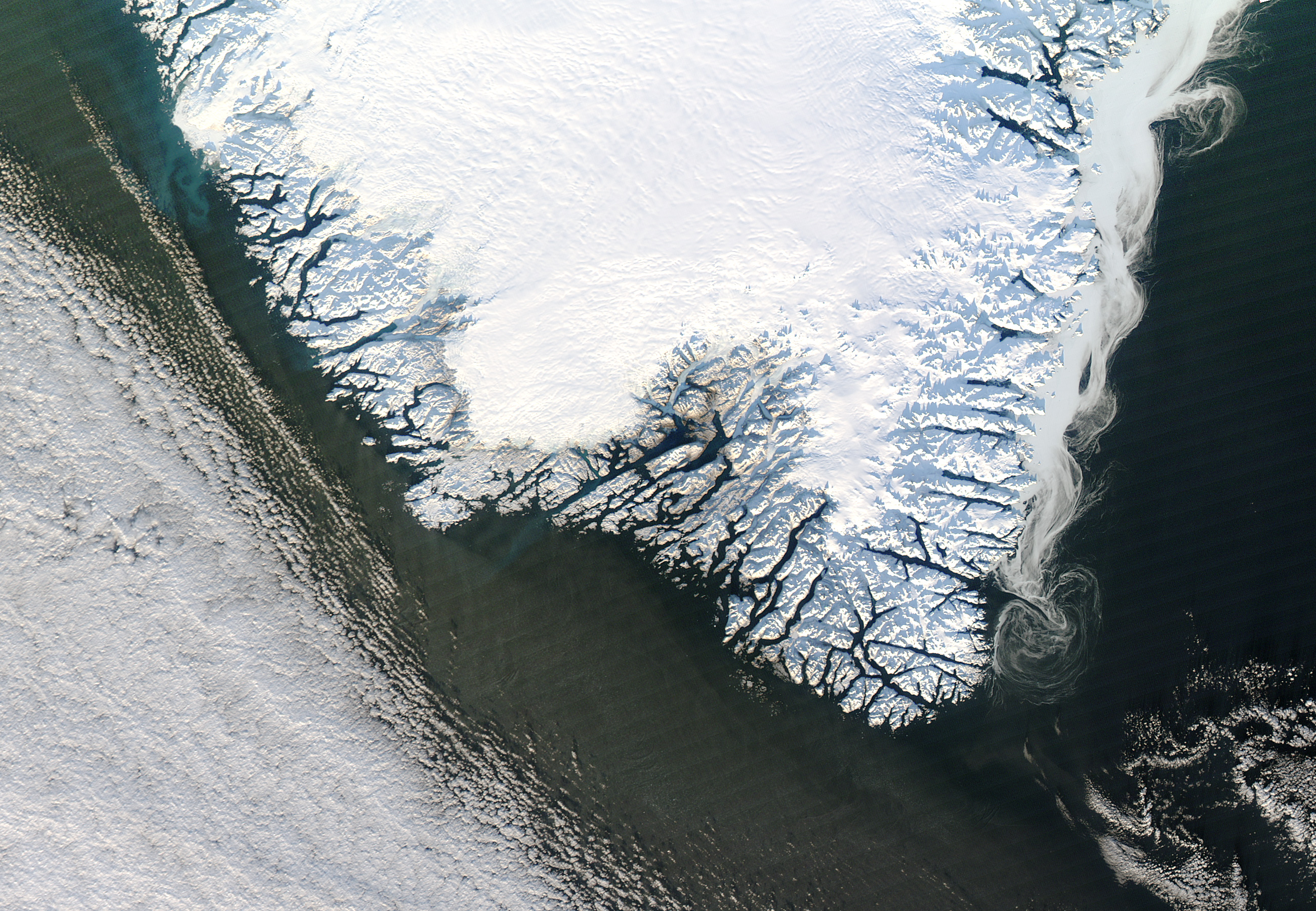
| NASA's Aqua satellite view of ice swirling off the coast of Greenland. |
NASA’s Aqua satellite is one in this fleet, mapping out the entire surface of the Earth—and in particular the water covering our world—every day or two. On December 30, 2012, it took this incredible picture of the southeast coast of Greenland in the late afternoon:
Right now, in the depth of winter, the ice over Greenland and the Arctic is growing. But come March, when temperatures warm, that ice will start to melt. Over the past few years the melting has been larger nearly every year, with the extent (area covered) and volume (total amount) of the ice decreasing rapidly. In late summer 2007 the historical record for lowest sea ice extent was broken, and then in 2011 that record was shattered again. Last year, Greenland experienced a melting season unlike anything that has been seen in a long time; there were unusual conditions that led to this event, such as a large heat wave, but the overall trend is clearly not good. And the reason is very, very clear; global warming, caused by human activity. Read More
Right now, in the depth of winter, the ice over Greenland and the Arctic is growing. But come March, when temperatures warm, that ice will start to melt. Over the past few years the melting has been larger nearly every year, with the extent (area covered) and volume (total amount) of the ice decreasing rapidly. In late summer 2007 the historical record for lowest sea ice extent was broken, and then in 2011 that record was shattered again. Last year, Greenland experienced a melting season unlike anything that has been seen in a long time; there were unusual conditions that led to this event, such as a large heat wave, but the overall trend is clearly not good. And the reason is very, very clear; global warming, caused by human activity. Read More